NWS Meteorologist Explains Monday's Heavy Rainfall
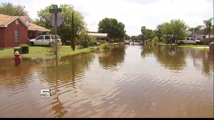
BROWNSVILLE – Several events caused the water to rise quickly during the flooding across the Rio Grande Valley Monday.
Fourteen inches of rain fell in some places; models and indicators used to forecast rainfall only forecasted two to four inches.
CHANNEL 5 NEWS spoke to National Weather Service Warning Coordination Meteorologist Barry Goldsmith.
"One cell decided to form near Kingsville around 2 o'clock and slow down and as it slowed down it pulled energy into it and it became a heavy precipitation or high precipitation super cell," he says.
Goldsmith says that super cell moved south, building off the energy the Valley had in the atmosphere from the recent heat wave.
He added the flow patterns in the Valley are complicated, not allowing water to recede fast enough.
Some places naturally pull more water, but it doesn't go anywhere.
For more information watch the video above.
More News