No wintry precipitation expected in the Valley amid weekend cold front
The First Warn 5 Weather Team is closely monitoring weather conditions as an Arctic blast makes its way across the state.
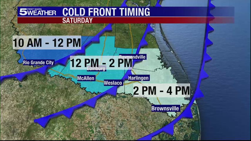
Saturday will be warm ahead of the front, then turn noticeably cooler and breezy overnight into Sunday. A few spotty showers are possible with the front, with slightly higher rain chances overnight into early Sunday, mainly near the coast.
Any lingering showers should taper off Sunday afternoon. No wintry precipitation is expected in the Rio Grande Valley.
The coldest temperatures are still expected Monday morning, with much of the Valley likely reaching near or below freezing for a few hours.
Some locations, especially Rio Grande City, Raymondville, and ranchland areas of northern Hidalgo and Starr counties, could briefly dip into the upper 20s to near 30 degrees.
Another cold morning is possible Tuesday, though freezing temperatures would likely be limited mainly to ranchland areas, as of now. Stay tuned for changes on Tuesday morning. The duration of freezing temperatures will depend largely on overnight cloud cover.
Download our free KRGV FIRST WARN 5 Weather app for the latest updates right on your phone.
You can also follow our KRGV First Warn 5 Weather team on Facebook and Twitter.
More News